


More than 40 Choquequirao Trek Facts on the ultimate guide to conquering this ancient trail!
Ultima actualización en 23 September, 2026 por Jhon Quispe
Last Updated on 23 September, 2026 by Jhon Quispe
What are the most important facts about Choquequirao?
Choquequirao is a remote Inca archaeological complex in the Cusco region reached mainly by multi-day trekking. The monumental site is commonly referenced around 3,033–3,050 m (9,951–10,007 ft), although official documents use higher figures for the broader archaeological park. Hiram Bingham visited the site in 1909 but did not discover it. In 2026, the Capuliyoc–Cachora route reopened on April 15 after a temporary rainy-season closure, while the proposed Choquequirao cable car remains a project and is not operating yet.
- Choquequirao facts at a glance
-
Choquequirao access and cable car facts for 2026
- 1. The main current approach uses the Cachora–Capuliyoc side
- 2. Capuliyoc is about 7.5 mi (12 km) by road from Cachora
- 3. There is no public road directly to Choquequirao
- 4. The Capuliyoc–Cachora route reopened on April 15, 2026
- 5. Choquequirao access can change after heavy rain
- 6. Alternative approaches exist, but availability is not constant
- 7. Independent trekking is possible
- 8. A guide can add value without being universally mandatory
- 9. The classic route is defined by major descent and ascent
- 10. Four-day Choquequirao itineraries are common
- 11. Five-day itineraries usually trade speed for more time
- 12. Longer routes can connect Choquequirao with Machu Picchu
- 13. The Choquequirao cable car is planned but not operating
-
Choquequirao history and identity facts
- 14. National Geographic highlighted Choquequirao for adventure travel
- 15. Choquequirao is often called the sister of Machu Picchu
- 16. Choquequirao is more extensive than the commonly visited core
- 17. Choquequirao overlooks the Apurímac canyon
- 18. Official sources use more than one elevation for Choquequirao
- 19. Choquequirao is commonly translated as “Cradle of Gold”
- 20. Hiram Bingham visited Choquequirao in 1909
- 21. Hiram Bingham did not discover an unknown Choquequirao
-
Choquequirao archaeology and architecture facts
- 22. Choquequirao developed during the Inca period
- 23. The complex includes upper and lower spatial divisions
- 24. Choquequirao contains multiple archaeological sectors
- 25. Main plazas organize important architectural areas
- 26. Agricultural terraces shape much of the landscape
- 27. White llama figures are built into some terrace walls
- 28. Water channels show sophisticated hydraulic planning
- 29. Choquequirao includes qolqas for storage
- 30. The complex contains ceremonial architecture such as an ushnu
- 31. Stone stairways connect structures across steep terrain
- 32. Large parts of Choquequirao remain under archaeological study
- 33. Choquequirao combines archaeological and natural value
-
Choquequirao altitude and terrain facts
- 34. Choquequirao is demanding even though the ruins are lower than Cusco
- 35. Canyon heat can matter as much as altitude
- 36. Acclimatization still matters
- 37. Trekking poles are particularly useful on Choquequirao
- 38. Trek-specific training is more useful than flat-ground exercise alone
- 39. Drier months are generally easier for trekking
- 40. Rainy-season conditions can interrupt access
- Choquequirao nature and wildlife facts
- Practical Choquequirao trek facts
- Common myths and outdated Choquequirao claims
- Plan your Choquequirao trek with the current access conditions
-
Frequently asked questions about Choquequirao
- How high is Choquequirao?
- Is Choquequirao open in 2026?
- Is the Choquequirao cable car open?
- Can you visit Choquequirao without hiking?
- Is Choquequirao bigger than Machu Picchu?
- How much of Choquequirao has been excavated?
- Do you need an Inca Trail-style permit for Choquequirao?
- How do you get to Choquequirao?
Beyond its remote access, Choquequirao is notable for llama-shaped terrace mosaics, sophisticated water systems, steep canyon geography and a history that began long before Hiram Bingham documented the site in 1909. Several popular claims about its size, excavation percentage and future cable car also need more careful interpretation.
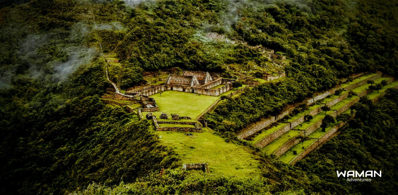
Choquequirao facts at a glance
| Detail | Planning reference |
| Location | Cusco region, above the Apurímac canyon on the western side of the Vilcabamba range |
| Monumental-site elevation | About 9,951–10,007 ft (3,033–3,050 m) in official tourism references |
| Broader park reference | Some official records use about 11,482 ft (3,500 m) as a broader park or general altitude reference |
| Main current approach | Cachora / Capuliyoc side followed by trekking |
| Common trek format | Multi-day trekking, commonly 4 or 5 days for the standard route |
| Main physical challenge | Major descent into the Apurímac canyon followed by sustained climbing |
| 2026 access update | Capuliyoc–Cachora route reopened April 15 after a temporary closure |
| Cable car | Planned infrastructure project; not operating for tourists as of September 2026 |
Choquequirao access and cable car facts for 2026
1. The main current approach uses the Cachora–Capuliyoc side
Most standard trekking itineraries reach the Cachora and Capuliyoc area by road before descending on foot into the Apurímac canyon. Trail conditions can change after heavy rain, maintenance or landslides.
2. Capuliyoc is about 7.5 mi (12 km) by road from Cachora
MINCETUR’s tourism inventory records approximately 7.5 mi (12 km) between Cachora and the Capuliyoc viewpoint, with an indicative driving time of around 30 minutes.
3. There is no public road directly to Choquequirao
Visitors cannot currently drive to the archaeological complex itself. The final approach still requires trekking, which remains one of the defining characteristics of visiting Choquequirao.
4. The Capuliyoc–Cachora route reopened on April 15, 2026
Access was temporarily suspended during the 2026 rainy season as a preventive safety measure. Peru’s Ministry of Culture later announced the official reopening of the Capuliyoc–Cachora route from April 15, 2026 after maintenance and safety coordination.
Travelers can review the official Ministry of Culture reopening notice.
5. Choquequirao access can change after heavy rain
A reopened route should not be interpreted as a guarantee that Choquequirao is accessible every day of the year. Landslides, trail damage, maintenance and extreme weather can still produce temporary restrictions.
6. Alternative approaches exist, but availability is not constant
Older maps and guides mention Huanipaca and other approaches. A route appearing in an old itinerary does not confirm that it is currently maintained, authorized or practical for visitors.
7. Independent trekking is possible
Choquequirao does not operate under the same permit-and-operator system as the Classic Inca Trail. Experienced hikers can organize some routes independently, although remote logistics, food, weather, navigation and emergency planning require careful preparation.
8. A guide can add value without being universally mandatory
A knowledgeable guide can interpret the archaeological sectors, help manage pacing and respond to changing trail conditions. This can be particularly useful for travelers unfamiliar with remote multi-day trekking in the Andes.
9. The classic route is defined by major descent and ascent
The trek drops steeply toward the Apurímac River and then climbs toward Marampata and Choquequirao. Much of that elevation loss and gain must be repeated on the return journey.
10. Four-day Choquequirao itineraries are common
A 4-day / 3-night format is widely used because it allows enough time to descend into the canyon, climb toward the archaeological area, explore the site and return without attempting the entire journey in an unrealistic schedule.
11. Five-day itineraries usually trade speed for more time
A five-day trek generally follows a similar core approach but gives additional margin for pacing, archaeological exploration and recovery between major climbs.
12. Longer routes can connect Choquequirao with Machu Picchu
Extended itineraries can continue through the Vilcabamba region before eventually connecting toward Machu Picchu. These journeys are a different trekking commitment from the standard out-and-back Choquequirao route.
13. The Choquequirao cable car is planned but not operating
No tourist cable car is transporting visitors to Choquequirao as of September 2026. The infrastructure project known as Mejoramiento de los Servicios Turísticos Públicos del Parque Arqueológico Choquequirao includes a cable-transport system intended to improve future access.
PROINVERSIÓN continued administrative and project-transfer work during 2026, which confirms that the project remains under development rather than in tourist operation.
For current project information, review the official PROINVERSIÓN Choquequirao project profile.

Important note:
Do not book a Choquequirao trip based on claims that a cable car already operates. Until authorities announce an official opening, plan the journey around the current trekking access.
Choquequirao history and identity facts
14. National Geographic highlighted Choquequirao for adventure travel
National Geographic included Choquequirao among its Best of the World 2023 adventure destinations. That recognition reflected its combination of remote trekking, Inca archaeology and mountain scenery rather than an official ranking of the world’s single best adventure destination.
15. Choquequirao is often called the sister of Machu Picchu
The comparison comes from shared Inca architecture, agricultural terraces, dramatic mountain settings and the role both places now play in Peruvian tourism. Their access, archaeological history and visitor infrastructure are nevertheless very different.
16. Choquequirao is more extensive than the commonly visited core
The archaeological landscape extends well beyond the sectors most visitors see. However, claims that Choquequirao is exactly “twice the size of Machu Picchu” depend on which boundaries and archaeological areas are being compared.
17. Choquequirao overlooks the Apurímac canyon
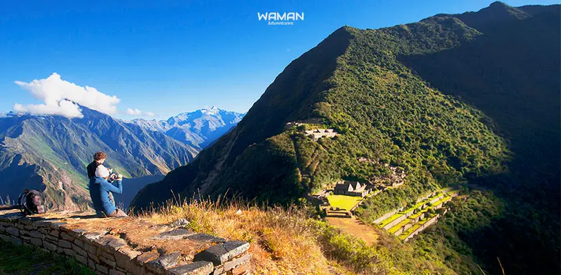
The complex occupies steep terrain above the Apurímac River on the western side of the Vilcabamba range. This geography explains both its dramatic setting and the demanding nature of the trek.
18. Official sources use more than one elevation for Choquequirao
MINCETUR’s inventory contains a general altitude field of about 11,482 ft (3,500 m), while its observations place the archaeological complex itself at roughly 9,951 ft (3,033 m). Other official tourism material uses about 10,007 ft (3,050 m).
These figures should not be treated as if every structure occupies one identical elevation across the wider archaeological park.
19. Choquequirao is commonly translated as “Cradle of Gold”
The name is generally connected with Quechua roots and widely translated as “Cradle of Gold.” Historical spelling and linguistic interpretation can vary between sources.
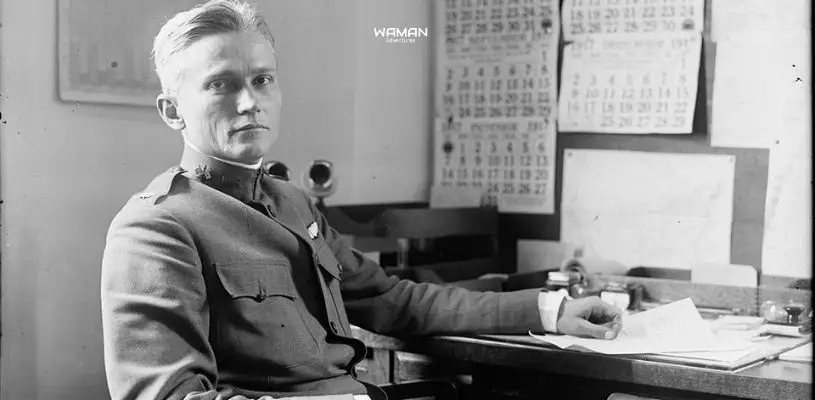
20. Hiram Bingham visited Choquequirao in 1909
Bingham documented and mapped the archaeological site during his work in the region. His visit helped bring Choquequirao to wider international attention.
21. Hiram Bingham did not discover an unknown Choquequirao
Choquequirao was already known locally and had been described by earlier visitors. Nineteenth-century accounts include references by travelers such as Eugène de Sartiges and Léonce Angrand, so describing Bingham as the site’s sole “discoverer” is misleading.
Choquequirao archaeology and architecture facts
22. Choquequirao developed during the Inca period
The complex took shape during the expansion of the Inca state in the 15th century. Older tourism accounts often attribute construction directly to Pachacutec, while Peruvian references also associate major development with later Inca rulers.
23. The complex includes upper and lower spatial divisions
Descriptions of Choquequirao often distinguish upper and lower areas, sometimes interpreted through the Andean concepts of hanan and hurin. These form part of a much more complex archaeological layout.
24. Choquequirao contains multiple archaeological sectors
The site is not simply one central plaza. Archaeological plans identify numerous sectors with different architectural and possible functional characteristics, and numbering can vary according to the plan being used.
25. Main plazas organize important architectural areas
Public and ceremonial spaces connect with kallankas, residential structures, terraces and other Inca constructions adapted to steep mountain terrain.
26. Agricultural terraces shape much of the landscape
Terraces helped support cultivation, drainage, erosion control and the use of extremely steep slopes. They are also among the site’s most visually distinctive architectural features.
27. White llama figures are built into some terrace walls
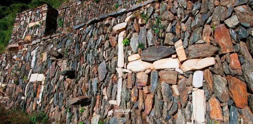
One of Choquequirao’s most unusual features is a group of stylized llama figures created with contrasting pale stones embedded into terrace walls.
28. Water channels show sophisticated hydraulic planning
Channels, fountains and drainage structures reveal how Inca builders managed water across the steep archaeological landscape.
29. Choquequirao includes qolqas for storage
Structures identified as qolqas formed part of the wider Inca system for storing and managing food and other supplies.
30. The complex contains ceremonial architecture such as an ushnu
An ushnu is a ceremonial platform associated with Inca ritual and political activity. Its presence supports the interpretation of Choquequirao as more than a simple residential settlement.
31. Stone stairways connect structures across steep terrain
Stairways link plazas, terraces and architectural sectors at different elevations. Exploring the ruins therefore still requires considerable walking after reaching the archaeological complex.
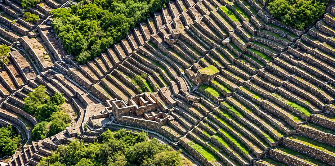
Choquequirao’s architecture adapts terraces and stone structures to steep Andean slopes.
32. Large parts of Choquequirao remain under archaeological study
The often-repeated statement that “only 30% has been excavated” is difficult to support as a precise current figure. A safer conclusion is that substantial areas of the wider complex remain unexcavated, partially investigated or under continuing study.
33. Choquequirao combines archaeological and natural value
The archaeological complex sits within a wider protected landscape containing canyon ecosystems, native forest and wildlife habitat. This overlap between cultural heritage and biodiversity is one of the distinctive characteristics of the region.
Choquequirao altitude and terrain facts
34. Choquequirao is demanding even though the ruins are lower than Cusco
The archaeological complex is around 9,951–10,007 ft (3,033–3,050 m), below central Cusco. The physical challenge comes mainly from repeated elevation loss and gain through the canyon rather than one exceptionally high mountain pass.
35. Canyon heat can matter as much as altitude
Lower sections around the Apurímac canyon can be much warmer than the archaeological area. Sun exposure, hydration and sustained climbing can therefore be major factors during the trek.
36. Acclimatization still matters
Travelers arriving from low elevation benefit from spending time in the Andes before beginning a demanding multi-day trek. Acclimatization can help the body adjust, but it does not replace fitness or guarantee that altitude symptoms will not occur.
For detailed preparation at elevation, use the Cusco acclimatization guide.
37. Trekking poles are particularly useful on Choquequirao
Poles can improve stability on loose or wet terrain and reduce strain during the long descents and climbs that characterize the route.
38. Trek-specific training is more useful than flat-ground exercise alone
Regular hiking, stair climbing, cardiovascular work and leg-strength training better reflect the terrain than exercise performed exclusively on flat ground.
There is no universal rule that every traveler must begin training exactly three months in advance. Preparation time depends on current fitness and trekking experience.
39. Drier months are generally easier for trekking
April through October is commonly considered the more favorable planning window because rainfall is generally lower than during the wettest months. A dry-season trip still does not guarantee cloudless skies, warm nights or perfect trail conditions.
40. Rainy-season conditions can interrupt access
Heavy rain can cause landslides, trail damage and preventive closures. The temporary 2026 closure and subsequent April reopening are a recent example of why current access conditions should be checked before departure.
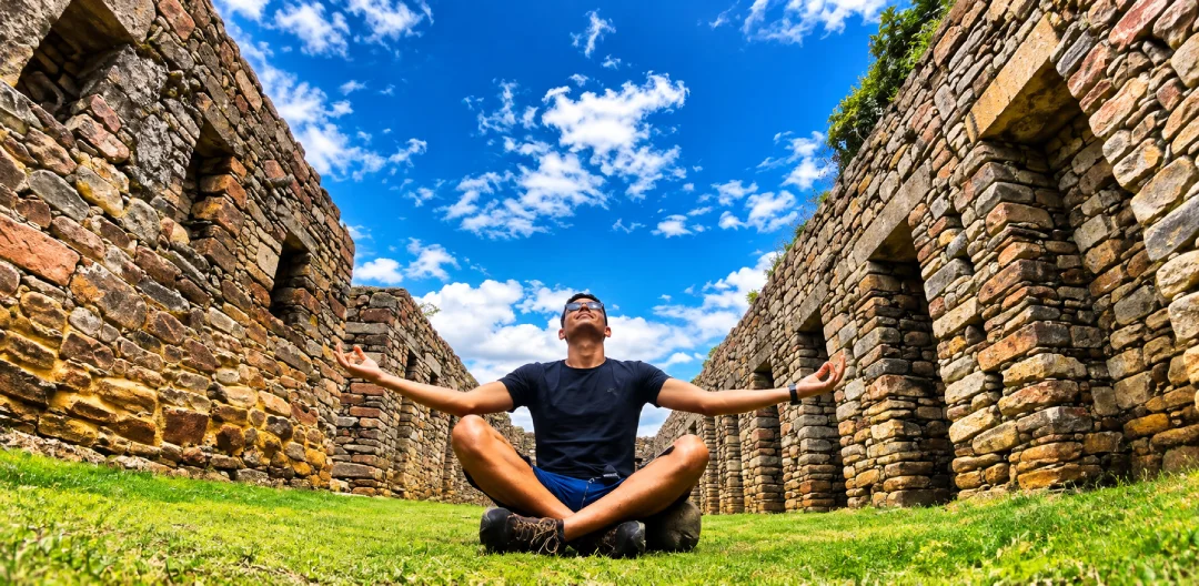
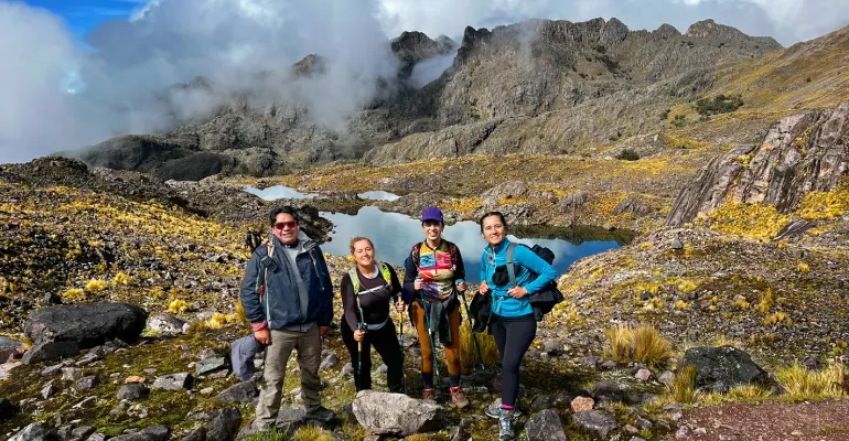
Reaching the ruins is only part of the physical effort required at Choquequirao.
For trek duration, weather and difficulty in greater depth, use the complete Choquequirao Trek guide.
Choquequirao nature and wildlife facts
41. The route crosses several ecological zones
The trek moves through dry canyon environments, scrub vegetation, mountain zones and more humid forest. Rapid elevation changes help explain the diversity of ecosystems around Choquequirao.
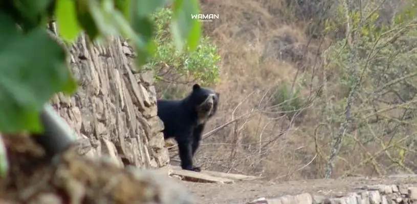
42. Spectacled bears live in the wider conservation landscape
The Andean spectacled bear occurs in protected ecosystems surrounding Choquequirao. Seeing one during a trek is possible but never guaranteed, and wildlife should never be approached or fed.
43. Andean condors can appear above the canyon
The canyon and mountain environment can provide opportunities to see Andean condors when conditions are favorable. The condor is a bird and should not be mixed into lists of mammal species.
44. Orchids, ferns and native plants occur along the route
Vegetation changes with elevation and moisture. Orchids, ferns, bromeliads and native trees form part of the broader ecological diversity around Choquequirao.

45. Butterflies are common in warmer sections
Lower and more humid areas support a wide variety of insects, including colorful butterflies. Their abundance changes with elevation, season and weather.

Practical Choquequirao trek facts
46. Multi-day itineraries use camps along the route
Chiquisca, Marampata and other camping areas can appear in different itineraries, but the exact overnight plan depends on trek duration, trail conditions, operator logistics and campsite availability.
47. Pack animals are commonly used on organized treks
Mules or horses can carry camping equipment, food and part of the group load. Weight allowances and animal-support policies depend on the operator and should be confirmed on the itinerary actually booked.
48. Packing light matters
A practical personal daypack normally prioritizes water, sun protection, rain protection, warm layers, personal medication, trekking poles, a headlamp and a portable battery.
For a complete equipment checklist rather than a condensed fact, use the Choquequirao preparation guide.
49. There is no single official minimum age that determines readiness
Age alone does not determine whether someone is prepared for Choquequirao. Endurance, trekking experience, heat tolerance, trail confidence and the ability to manage repeated steep climbs are more useful considerations.
50. Personal medication is more appropriate than a generic drug list
Bring medication you normally require and a basic personal first-aid kit. Prescription medicines, antibiotics and altitude medication should not be recommended generically to every trekker without individualized medical guidance.

Common myths and outdated Choquequirao claims
| Common claim | Better interpretation |
| “Hiram Bingham discovered Choquequirao in 1909.” | He documented a site already known locally and visited by earlier travelers. |
| “Choquequirao is exactly twice the size of Machu Picchu.” | Choquequirao is extensive, but an exact ratio depends on which archaeological boundaries are compared. |
| “Only 30% of Choquequirao has been excavated.” | Large areas remain unexcavated or under study, but a precise current percentage is difficult to verify. |
| “Choquequirao is guaranteed to be open year-round.” | Access can close temporarily because of rain, landslides or maintenance, as happened in 2026. |
| “The Choquequirao cable car is opening soon.” | The project remains under development and no tourist cable car is operating as of September 2026. |
Plan your Choquequirao trek with the current access conditions
Choquequirao still requires a serious multi-day trekking commitment, and current trail conditions matter more than old claims about shortcuts or a future cable car. Before fixing dates, confirm the open approach, trek duration and support services that match your experience and fitness.
If you want help coordinating the route and current access conditions, talk to a Waman Adventures travel specialist about your Choquequirao trek.
Frequently asked questions about Choquequirao
How high is Choquequirao?
Is Choquequirao open in 2026?
Is the Choquequirao cable car open?
Can you visit Choquequirao without hiking?
Is Choquequirao bigger than Machu Picchu?
How much of Choquequirao has been excavated?
Do you need an Inca Trail-style permit for Choquequirao?
How do you get to Choquequirao?
Share:

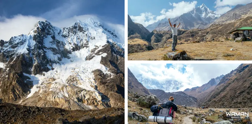


Related tours you might be interested in
Enjoy unique experiences in Cusco and Machu Picchu with the peace of mind that comes from working with a local travel agency

INCA JUNGLE TREK TO MACHU PICCHU 4D/3N – GROUP SERVICE
Experience adventure, adrenaline, culture, and nature in the trek that has it all! The Inca Jungle...

05 DAY CHOQUEQUIRAO TREK – PRIVATE SERVICE
The route offers biodiversity of flora and fauna, so that along the trail you will experience...
4 Day Lares Trek to Machu Picchu
Discover the adventure of hiking ancient trails all the way to Machu Picchu! Experience the magic...

05 Day Salkantay Trek To Machu Picchu – Group Service
CONQUER THE ANDES, CONQUER YOURSELF: SALKANTAY TREK ADVENTURE During this trip to Salkantay Trek,...

