Top 10 Highest Mountains in South America
Ultima actualización en 9 September, 2026 por Jhon Quispe
Last Updated on 9 September, 2026 by Jhon Quispe
What is the highest mountain in South America?
Aconcagua is the highest mountain in South America and the Andes, reaching about 22,837 ft (6,961 m) above sea level in Mendoza, Argentina. Beyond South America, it holds two other major distinctions: it is the highest peak in the Americas and the highest mountain outside Asia.
-
South America’s 10 highest mountains, ranked by elevation
- 1. Aconcagua Mountain – 22,841 ft (6,962 m)
- 2. Ojos del Salado Volcano – 22,615 ft (6,893 m)
- 3. Mount Pissis – 22,293 ft (6,795 m)
- 4. Mount Huascarán – 22,205 ft (6,768 m)
- 5. Bonete Chico Volcano – 22,175 ft (6,759 m)
- 6. Tres Cruces South – 22,139 ft (6,748 m)
- 7. Llullaillaco Volcano – 22,110 ft (6,739 m)
- 8. Cerro Mercedario – 22,047 ft (6,720 m)
- 9. Cazadero / Walther Penck – 21,844 ft (6,658 m)
- 10. Incahuasi Volcano – 21,778 ft (6,638 m)
- The Andes: South America’s major mountain range
- Seeing the Andes without climbing a 19,685-foot (6,000-meter) peak
- Explore Peru’s Andes beyond the highest peaks
-
Frequently asked questions about South America’s highest mountains
- What is the highest mountain in South America?
- What country has the highest mountain in South America?
- What are the three highest mountains in South America?
- Is Mercedario the seventh-highest peak in South America?
- Why does the ranking vary between different websites?
- Can you see South America’s highest mountains without summiting them?
- What is the best time of year to visit these mountains?
- Can you climb any of these mountains without technical mountaineering experience?
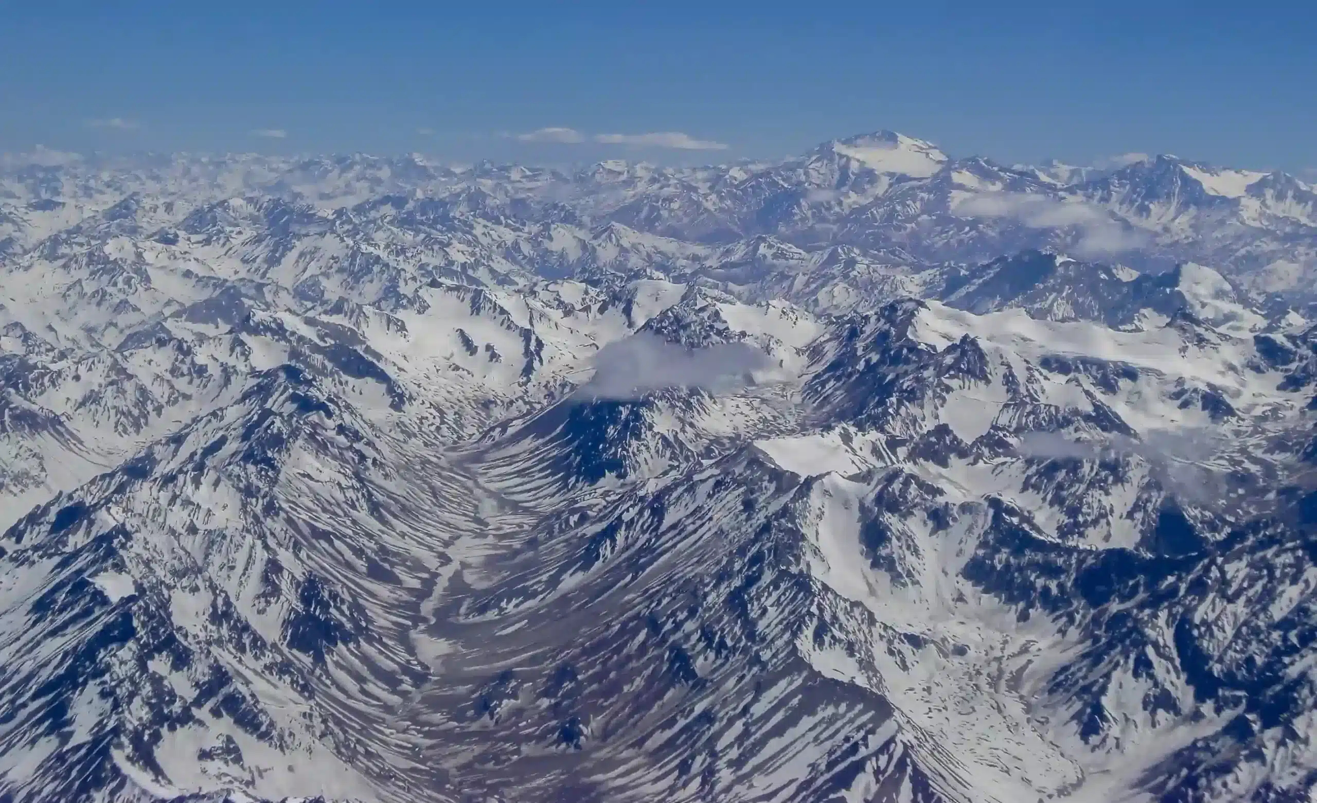
South America’s highest mountains are concentrated in the Andes, where several summits rise above 21,600 ft (6,600 m). Elevation, however, tells only part of the story. Access, climate, remoteness, protected-area regulations, and even the possibility of seeing a mountain without attempting its summit can differ greatly from one peak to another.
Mountain rankings can also vary slightly between sources because government agencies, topographic surveys, and mountaineering databases do not always use the same elevation measurements or criteria for defining individual peaks. This ranking follows current institutional figures where available and does not count subsidiary summits of the same mountain as separate entries.
South America’s 10 highest mountains, ranked by elevation
| MOUNTAIN | ELEVATION | LOCATION |
| Mount Aconcagua | 22,831 ft (6,959 m) | Mendoza, Argentina |
| Ojos del Salado Volcano | 22,615 ft (6,893 m) | San Francisco Pass, Argentina–Chile border |
| Pissis Volcano | 22,293 ft (6,795 m) | La Rioja–Catamarca border, Argentina |
| Mount Mercedario | 22,211 ft (6,770 m) | San Juan, Argentina |
| Mount Huascarán | 22,205 ft (6,768 m) | Yungay, Peru |
| Bonete Chico Volcano | 22,175 ft (6,759 m) | La Rioja, Argentina |
| Tres Cruces Volcano | 22,139 ft (6,748 m) | Atacama, Chile |
| Llullaillaco Volcano | 22,110 ft (6,739 m) | Border between Antofagasta and Salta, Chile and Argentina |
| Cazadero Volcano | 21,844 ft (6,658 m) | Catamarca–Atacama border, Argentina and Chile |
| Incahuasi Volcano | 21,778 ft (6,638 m) | San Francisco Pass, Argentina–Chile border |
Important note:
Published elevations are not identical across government agencies, historic surveys, modern topographic measurements, and mountaineering databases. When mountains are separated by only a few meters, these differences can change their position in a ranking. This list uses current institutional figures where available and treats each named mountain as one entry rather than counting subsidiary summits separately.
1. Aconcagua Mountain – 22,841 ft (6,962 m)
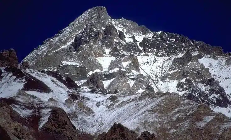
- Location: Aconcagua Provincial Park, Mendoza Province, Argentina.
- Elevation: 22,841 ft (6,962 m).
- Base city: Mendoza, with access toward the mountain through Uspallata and Route 7.
- Typical visiting window: November to March for most trekking and climbing activity; park access and rules vary by season.
- How to see it without summiting: Horcones, Route 7, and viewpoints around the entrance to Aconcagua Provincial Park.
Aconcagua is the highest mountain in the Americas, the highest point in both the Southern and Western Hemispheres, and the highest summit outside Asia. Its normal route is not generally considered highly technical, but that does not make the expedition easy. The extreme altitude, rapidly changing weather, and long days at elevation make proper acclimatization, physical preparation, and emergency planning essential.
Climbers and explorers have been drawn to the mountain for decades, but Aconcagua’s history reaches much further back. High-altitude Inca evidence found on the mountain shows that it also held ceremonial importance centuries before modern mountaineering began.
For current information on access, permits, reservations, and seasonal regulations, travelers can consult the official Aconcagua Provincial Park information.
2. Ojos del Salado Volcano – 22,615 ft (6,893 m)

- Location: Border area between Atacama in Chile and Catamarca in Argentina.
- Elevation: 22,615 ft (6,893 m).
- Base city: Copiapó in Chile; Fiambalá or Tinogasta in Argentina.
- Typical visiting window: December to March, depending on weather, road conditions, and access rules.
- How to see it without summiting: San Francisco Pass, Laguna Verde, and sections of Argentina’s Route of the Six Thousanders.
Ojos del Salado is widely recognized as the world’s highest active volcano. It rises in an exceptionally dry section of the high Andes, where cold, strong winds, long distances, and limited infrastructure shape almost every visit. Even reaching the surrounding area requires more planning than visiting a mountain with developed roads and services nearby.
There is no confirmed historic eruption comparable with those of more frequently active volcanoes, although fumarolic activity has been observed around the summit area. Its name is associated with the Salado River and with the Andean expression “ojo de agua,” used for a spring or water source.
3. Mount Pissis – 22,293 ft (6,795 m)
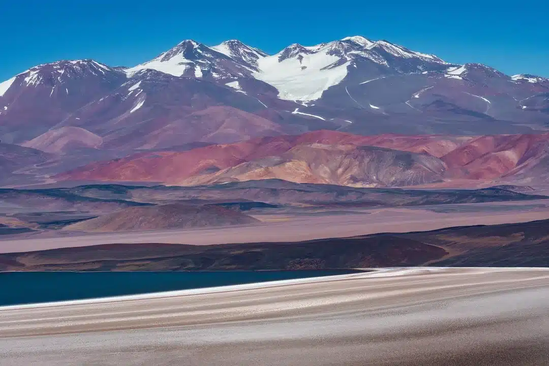
- Location: High Andean zone between Catamarca and La Rioja, Argentina.
- Elevation used in this ranking: 22,293 ft (6,795 m).
- Base city: Fiambalá is one of the main regional access points.
- Typical visiting window: December to March.
- How to see it without summiting: Balcón del Pissis and sections of the Route of the Six Thousanders.
Mount Pissis is an inactive stratovolcano and is commonly ranked as the third-highest mountain in South America when an elevation of 22,293 ft (6,795 m) is used. Its remoteness adds another layer of difficulty: approaches cross vast stretches of dry, high-altitude terrain where infrastructure and services are scarce.
Published measurements have changed over time, which is why some older rankings assign Pissis a slightly different elevation. Those variations do not alter its place among the highest mountains of the Andes, but they help explain why its exact position can differ from one list to another.
4. Mount Huascarán – 22,205 ft (6,768 m)
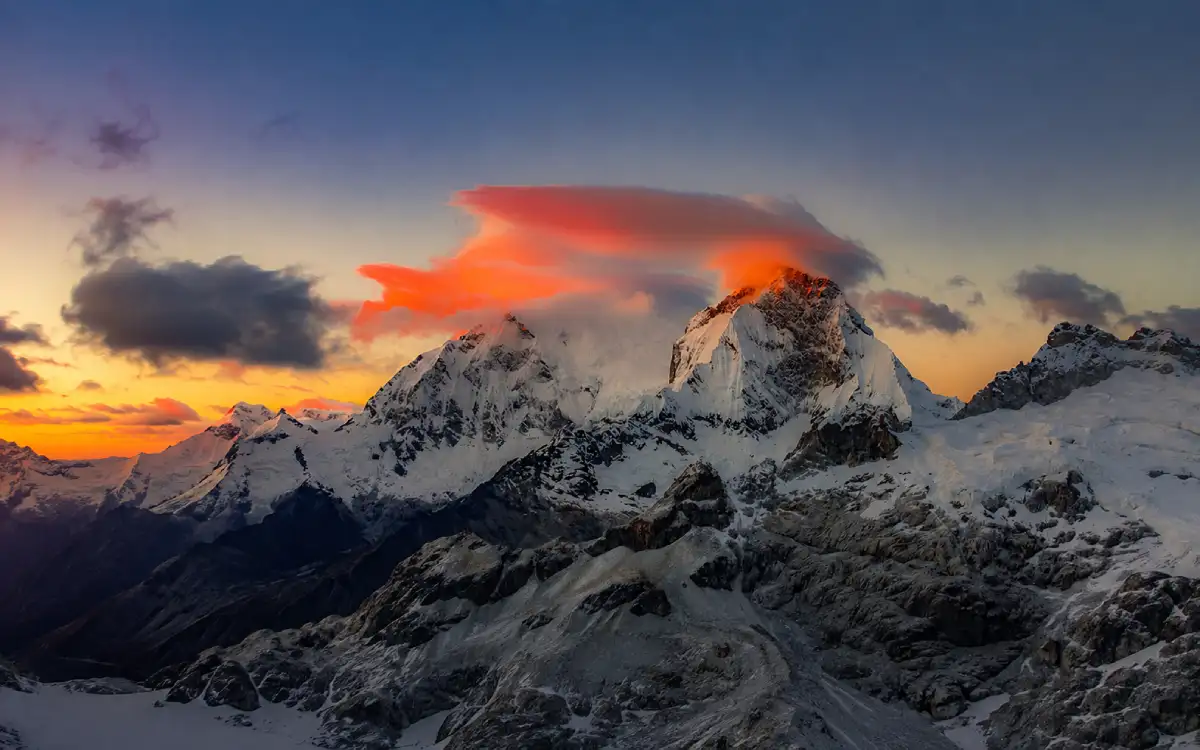
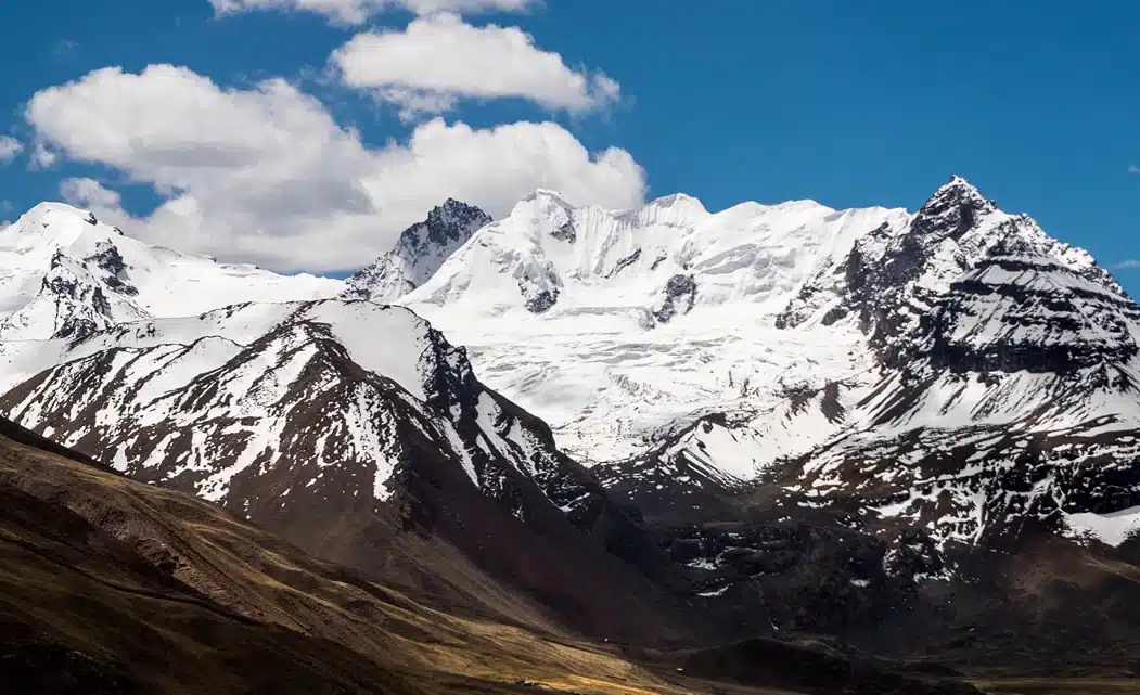
Snow-covered Huascarán mountain surrounded by mist and reddish sunset light in the Cordillera Blanca of Áncash, Peru.
- Location: Huascarán National Park, Áncash, Peru.
- Elevation: 22,205 ft (6,768 m).
- Base city: Huaraz is the main regional base; Yungay and Carhuaz provide access to nearby valleys and viewpoints.
- Typical visiting window: May to September generally brings drier conditions for mountain travel.
- How to see it without summiting: Callejón de Huaylas, Yungay, Llanganuco, and several viewpoints throughout the Cordillera Blanca.
Huascarán is the highest mountain in Peru and one of the best-known glaciated summits in the tropical Andes. It rises inside Huascarán National Park, a protected area where glaciers, high-altitude lakes, biodiversity, and dramatic mountain landscapes are concentrated within the Cordillera Blanca.
Huascarán Sur is the main objective for high-altitude climbers. Reaching its summit is not an ordinary trek: the ascent involves glacier travel, crevasses, avalanche exposure, and conditions that can change quickly. Anyone considering the climb needs the skills, preparation, equipment, and support appropriate for a technical mountaineering expedition.
Travelers who want to experience Peru’s mountain scenery without attempting a technical summit can compare regions, seasons, altitude, and trail difficulty in Waman Adventures’ trekking in Peru guide.
For current protected-area information and visitor guidance, the SERNANP official Huascarán National Park page provides the relevant details.
5. Bonete Chico Volcano – 22,175 ft (6,759 m)
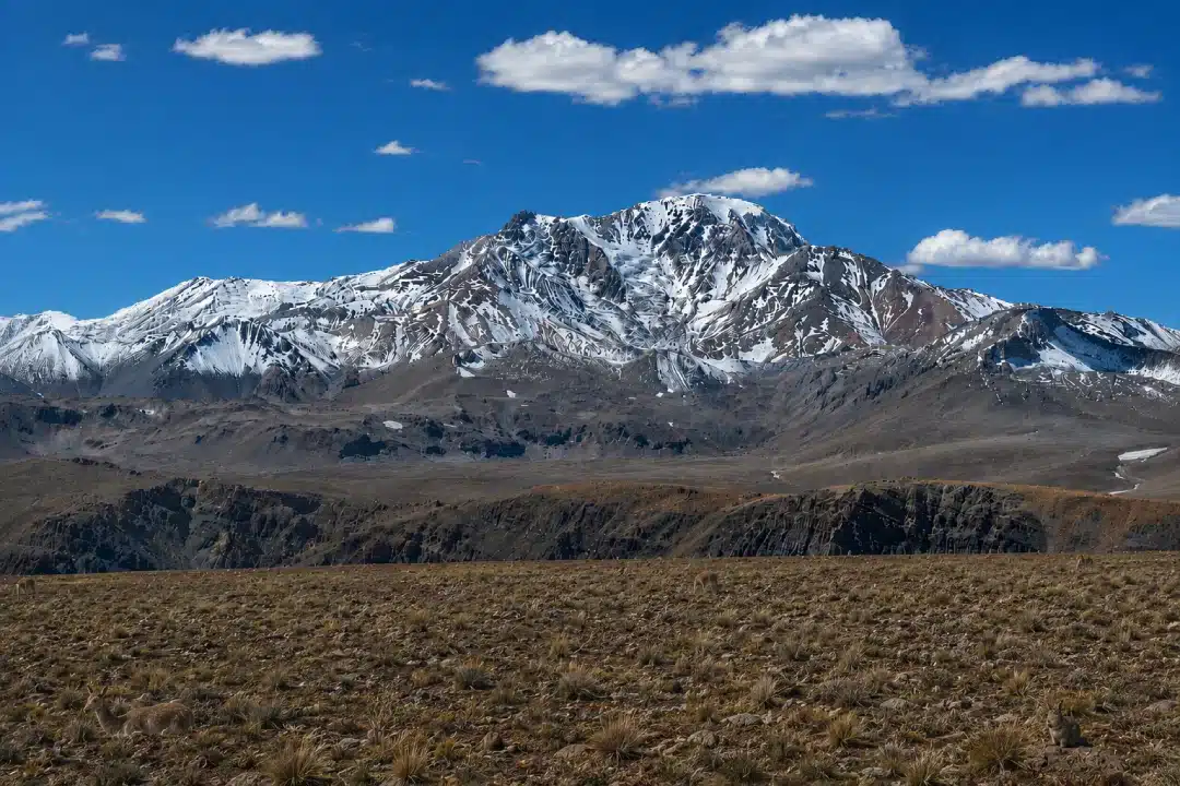
Nevado Bonete Chico rises above a dry high-Andean environment with sparse vegetation, rugged terrain and patches of snow across its slopes and summit.
- Location: La Rioja Province, Argentina.
- Elevation: 22,175 ft (6,759 m).
- Base area: Access is generally organized through remote high-Andean routes from La Rioja or neighboring Catamarca.
- Typical visiting window: December to March.
- How to see it without summiting: High-altitude routes associated with Laguna Brava and the broader Six Thousanders corridor.
Bonete Chico is less internationally known than Aconcagua or Ojos del Salado, yet its elevation places it among the highest mountains on the continent. Reaching the surrounding region means traveling through remote, arid, and exposed terrain, so dependable transport and careful logistical planning matter even for visitors who have no intention of climbing the mountain.
Its ascent history is also less straightforward than that of better-documented peaks. Modern mountaineering references generally place the first recorded ascent in the 20th century, while earlier exploration accounts need to be distinguished from confirmed summit records.
6. Tres Cruces South – 22,139 ft (6,748 m)
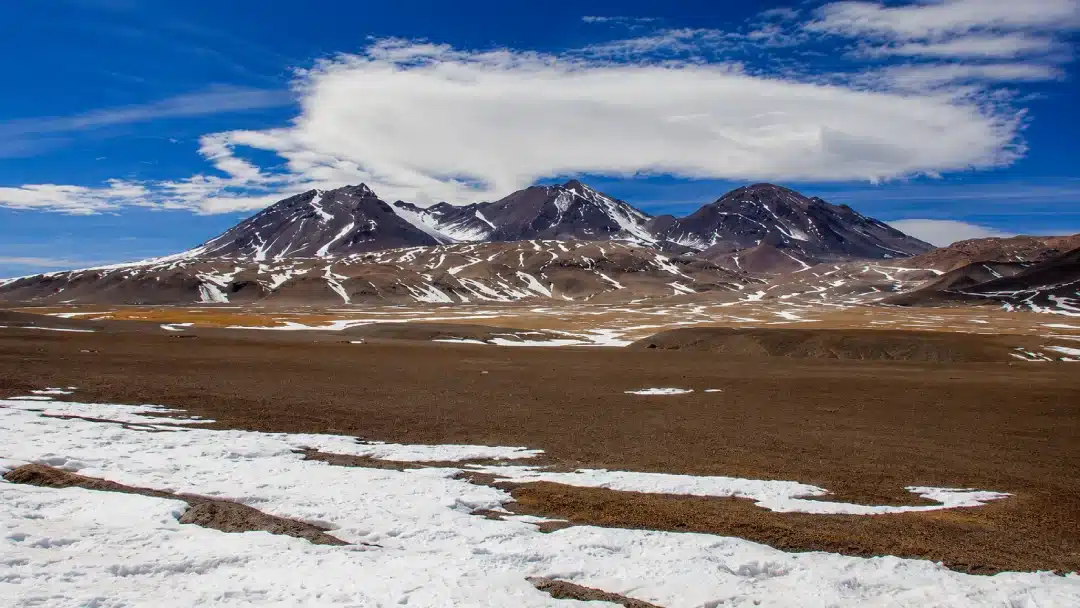
Nevado Tres Cruces is characterized by high summits, volcanic slopes and broad arid plains, typical features of the high-altitude landscape in this part of the Andes.
- Location: Border region between Atacama in Chile and Catamarca in Argentina.
- Elevation of the South Summit: 22,139 ft (6,748 m).
- Base city: Copiapó in Chile; approaches from Argentina commonly use the San Francisco Pass corridor.
- Typical visiting window: November to March.
- How to see it without summiting: Santa Rosa Lagoon, Negro Francisco Lagoon, and the Salar de Maricunga area.
Nevado Tres Cruces is a volcanic massif formed by three principal summits. The South Summit is the highest, while the Central and North summits reach lower elevations.
The surrounding landscape combines high-altitude lagoons, salt flats, volcanic terrain, and wildlife adapted to the Atacama and puna environments. For most travelers, visiting the lagoons and nearby viewpoints is a far more practical way to experience this landscape than organizing a high-altitude summit attempt.
7. Llullaillaco Volcano – 22,110 ft (6,739 m)
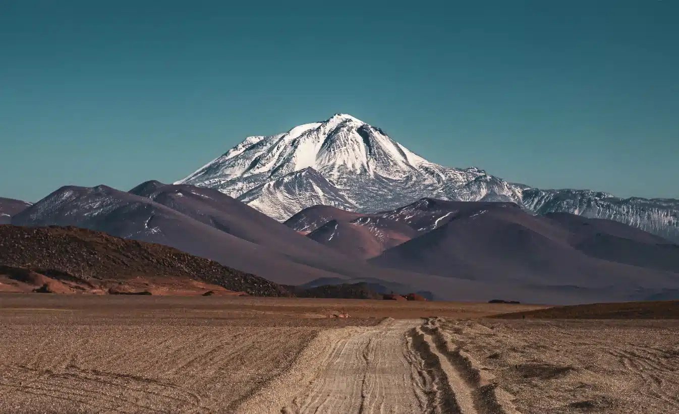
- Location: Border zone between Antofagasta, Chile, and Salta, Argentina.
- Elevation: 22,110 ft (6,739 m).
- Base city: Antofagasta or San Pedro de Atacama from Chile; Salta from Argentina, depending on the approach.
- Typical visiting window: Conditions vary considerably, and remote high-altitude access requires careful planning.
- How to see it without summiting: Remote Altiplano roads and high-desert viewpoints in the broader Llullaillaco region.
Llullaillaco is one of the highest volcanoes on Earth and one of the Andes’ most important high-altitude archaeological sites. On the Chilean side, the mountain lies within Llullaillaco National Park. Access is remote, and authorization may be required for certain activities, so the type of visit and current regulations need to be confirmed in advance.
Did you know…?
In 1999, archaeologists discovered three exceptionally well-preserved Inca children near the summit. The find became one of the most important high-altitude archaeological discoveries in South America.
Current protected-area information is available from CONAF’s official Llullaillaco National Park page.
8. Cerro Mercedario – 22,047 ft (6,720 m)
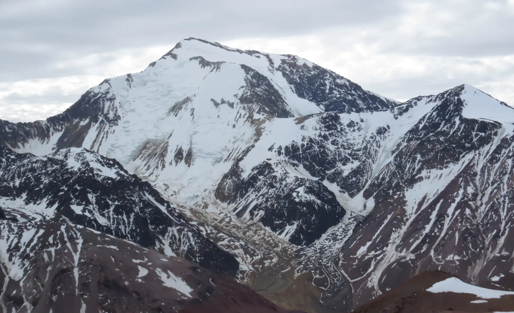
- Location: Calingasta, San Juan Province, Argentina.
- Elevation used in this ranking: 22,047 ft (6,720 m).
- Base city: Barreal and the broader Calingasta area.
- Typical visiting window: November to March for most mountaineering activity.
- How to see it without summiting: Parts of the Calingasta Valley and the high-mountain landscapes around Barreal.
Mercedario is the highest point in the Cordillera de la Ramada and one of Argentina’s major expedition mountains. It is also a good example of why lists of South America’s highest peaks do not always agree.
Older references frequently give Mercedario an elevation of about 22,211 ft (6,770 m), while more recent Argentine institutional information uses 22,047 ft (6,720 m). With the 6,720 m figure and the group of peaks followed in this ranking, Mercedario occupies eighth place. A list using another elevation or different criteria for defining independent peaks may position it higher.
9. Cazadero / Walther Penck – 21,844 ft (6,658 m)
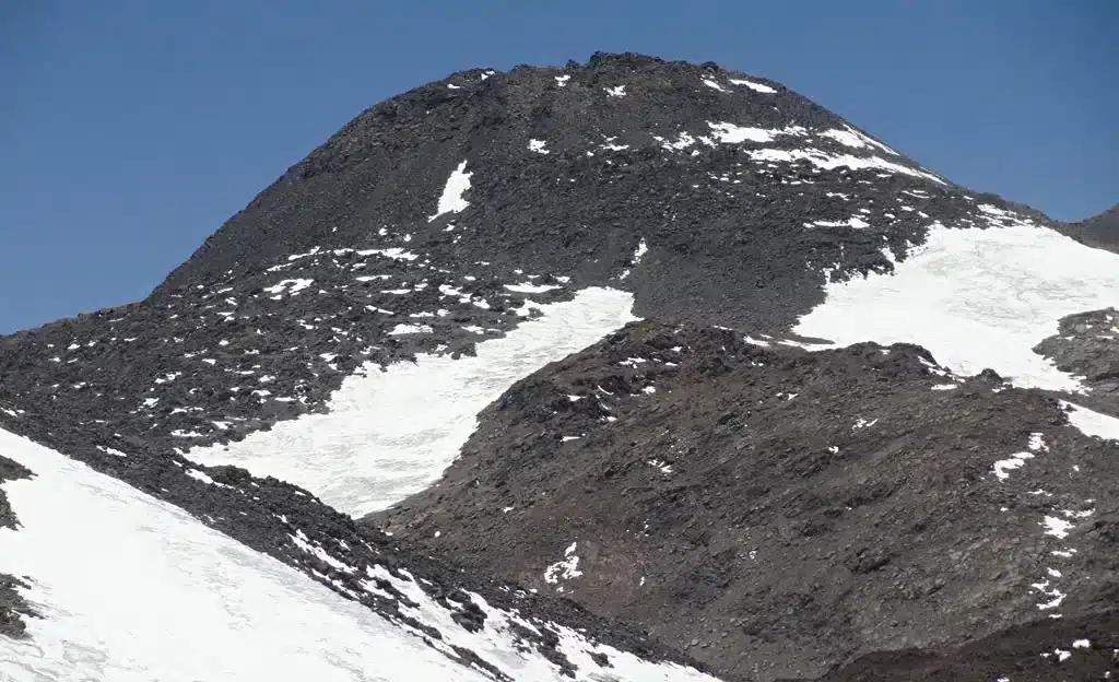
- Location: High Andes near the Catamarca–Atacama frontier.
- Elevation used in this ranking: 21,844 ft (6,658 m).
- Base city: Fiambalá or Tinogasta in Argentina; Copiapó in Chile.
- Typical visiting window: November to March.
- How to see it without summiting: San Francisco Pass and sections of the Route of the Six Thousanders.
This mountain appears under several names, including Cazadero, Walther Penck, and Tipas. That variation can complicate comparisons between historical maps, expedition reports, and modern databases, especially when different sources use different names for the same high-Andean feature.
The surrounding volcanic terrain is remote, and visiting the area is generally part of a broader high-Andean journey rather than a simple roadside stop. Even without a summit attempt, travelers need dependable transportation, sufficient water and fuel, and enough time to adjust to both the altitude and changing road conditions.
10. Incahuasi Volcano – 21,778 ft (6,638 m)
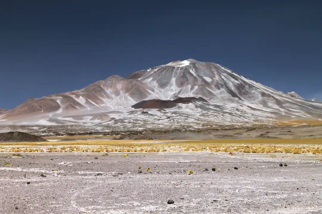
- Location: San Francisco Pass area between Catamarca, Argentina, and Atacama, Chile.
- Elevation used in this ranking: 21,778 ft (6,638 m).
- Base city: Fiambalá or Tinogasta in Argentina; Copiapó in Chile.
- Typical visiting window: November to March.
- How to see it without summiting: San Francisco Pass and sections of the Route of the Six Thousanders.
Incahuasi is a large stratovolcano within a chain of exceptionally high volcanic peaks that also includes San Francisco, El Fraile, El Muerto, Ojos del Salado, and Tres Cruces. Its broad, dry surroundings are typical of the Puna de Atacama.
Its published elevation varies slightly between sources, but for travelers the practical difference between those measurements matters far less than the conditions on the ground. Altitude, long distances, road conditions, and limited services are the factors that will shape a journey through this remote region.
Important note:
These mountains are expedition-level environments. Seeing one from a road or viewpoint is very different from attempting to reach its summit. Before planning an ascent, it is important to confirm permits, protected-area regulations, road access, weather conditions, rescue coverage, guide requirements, and the time needed for proper acclimatization.
The Andes: South America’s major mountain range
The Andes extend along the western side of South America through Venezuela, Colombia, Ecuador, Peru, Bolivia, Chile, and Argentina. They developed through long-running tectonic processes associated mainly with oceanic plates moving beneath the South American Plate. Over time, these processes formed the mountain and volcanic systems that contain nearly all of the continent’s highest peaks.
Several mountains in this ranking rise above 19,685 ft (6,000 m). At that elevation, the number on the map becomes only one part of the challenge. Wind, cold, glacier conditions, remoteness, access, and expedition logistics can determine how demanding a visit will be. A roadside viewpoint may be accessible to ordinary travelers, while reaching a summit could require acclimatization, permits, technical equipment, professional support, and substantial mountaineering experience.
Seeing the Andes without climbing a 19,685-foot (6,000-meter) peak
Experiencing the high Andes does not necessarily mean organizing a technical expedition. Aconcagua can be seen from Horcones and the Route 7 area, several of the Atacama’s highest peaks are visible from high-altitude roads and lagoons, and Huascarán can be appreciated from valleys and viewpoints throughout the Cordillera Blanca.
In Peru, trekking routes through the Cordillera Blanca and other Andean regions bring travelers close to dramatic mountain scenery without requiring a technical summit attempt. Waman Adventures’ guide to trekking in Peru compares regions, altitude, seasons, and trail difficulty, which can help travelers choose a route that matches their available time and experience.
Explore Peru’s Andes beyond the highest peaks
The mountains in this ranking show just how varied the Andes are, from the dry volcanic plateaus of Argentina and Chile to the glaciated Cordillera Blanca in Peru. For travelers whose journey is focused on Peru, it is also possible to plan your trip through Peru with Waman Adventures and combine Andean landscapes with destinations such as Cusco, the Sacred Valley, and Machu Picchu.